Digital Elevation Model (DEM)

Introduction:
Digital Elevation Model is basically a three dimensional computer graphic representation of terrain or surface, typically Earth or Moon, March and so on. It used as a precursor of orthophoto and is also used as a base for relief map. It could also be defined as a special case of interpolated, continues surface.
The term DEM is used generally to describe the height information without any further consideration of the surface, and usually used as a generic term to describe both Digital surface Model (DTM) and Digital Surface Model (DSM), which sometimes all the three terms are used synonymous. Some of data provider such as USGS define them the same way.
Also sometimes, DEM is defined as a subset or the most fundamental component of DTM. Or defining DEM as a rectangular matrices (altitude matrix) and DTM as Triangular Irregular Network (TIN)
Type s of DTM or, methods of representing DEM:
Mathematically defined surfaces.
Raster:
altitude matrices. Also known as height map.
Point or line images (counters and profile)
Vector base Triangular Irregular Network (TIN).
A main difference between DSM and DTM could be descried as shown in the following graph:
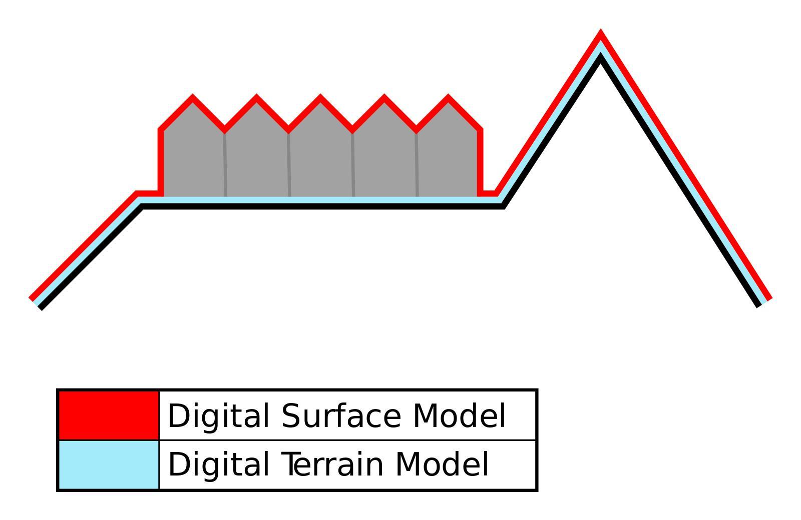
DSM: surface of Earth with all objects above it.
DTM: only terrain or surface of the earth.
DTM could be computed from high resolution DSM with very complex algorithms. For DSM, its data sets are obtained from satellites or airplanes or any other flying methods are DSM such as: STRM, Aster gDEM
Generally, height information are obtained commonly by remote sensing methods (photogrammetry, Lidar, IfSAR) and sometimes with land surveying.

Comments
Post a Comment