Global Navigation Satellite System (EGONS)
Introduction
Global Navigation Satellite System (GNSS) is an umbrella term that include vase range of satellite navigations system that provide geospatial and positioning data in a global range covering, systems such as: GPS (USA) , GLONASS (Russia), QZSS (Japan) ...etc.
Here well define the European Geostationary Navigation Overlay Service (EGONS) as an example of GNSS,its history, system segments, explore satellites names and their signals, navigation, Reference from and time and accuracy.
Definition
The European Geostationary Navigation Overlay Service (EGNOS) is a satellite based augmentation system (SBAS) developed by the European Space Agency and EUROCONTROL. It was intended for general Purpose application and freely accessible. also supply GPS, GLONASS and Galileo by sending report about their reliability and accuracy of their positioning data and provide corrections

History
The system started in 2009 after the European Commission signed a contract with the European Satellite Services Provider to run it. And the official start was on the 1st of October 2009.
In 2011 the system was certified to be used in safety of life applications. And In 2012 EGONS data service became available.
Under a project called EGONS Service Extension to South Africa (ESESA) there were efforts to extend EGONS Coverage to the south of Africa region.
Segments of the system
EGNOS consists of mainly four functional segments:
Ground segment
The ground segment consist of:
A network of 40 Ranging Integrity Monitoring Stations (RIMS): its main function is to collect data from GPS and sent them every second to the Central Processing Facilities (CPF) of each (MCC).
2 Mission Control Centres (MCC): Acts as EGNOS system’s brain, it receivers information from (RIMS) ns generate corrections.
6 Navigation Land Earth Stations (NLES): for redundancy purposes there are two NILESs for each GEO, it transmit the messages received from CPF to the GEO.
The EGNOS Wide Area Network (EWAN): provides the communication network for all the components of the ground segment.
Support segment
It performs the activities of system operations planning and performance assessment, and they are:
The Performance Assessment and Checkout Facility (PACF): provides support in performance analysis, troubleshooting and operational procedures, as well as upgrade of specification and validation, and support to maintenance.
The Application Specific Qualification Facility (ASQF): provides civil aviation and aeronautical certification authorities with the tools to qualify, validate and certify the different EGNOS applications.
Space Segment
It consist of three geostationary satellites providing corrections and integrity information for GPS satellites in the L1 frequency band (1575,42 MHz). And at any where and time at least two of the three GEOs provide an operational signal.
User Segment
EGNOS receivers provide their users’ their positions with integrity and accurately, and the user must use an EGNOS-compatible receiver to receive EGNOS signals.
Satellites
Satellites list
The satellites of the space segment are as follow:
Table 1: Given data
Satellites signals
The satellites transmit right-hand circularly polarised (RHCP) signals in the L1 band (1575.42 MHz). The broadcast signal is a combination of a 1023-bit PRN navigation code of the GPS family and a 250 bits per second navigation data message carrying the corrections and integrity data elaborated by the EGNOS ground segment.
Navigation Message
The Navigation Data is composed of a number of different Message Types:
Table 2: Message types (MT) and purposes.
Reference Frame and time
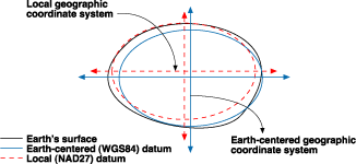
Position coordinates and time information are referenced to a reference systems established by the EGNOS system which is called the EGNOS Network Time (ENT) timescale and the EGNOS Terrestrial Reference Frame (ETRF) which is an independent realisation of the International Terrestrial Reference System (ITRS2).
References
EGNOS Open Service (OS) Service Definition Document.
https://en.m.wikipedia.org/wiki/European_Geostationary_Navigation_Overlay_Service


Comments
Post a Comment